マカオからメッセージが届きました。 / A message has arrived from Macao!
今年の「私たちの身のまわりの環境地図作品展」でIGU-LUCC議長賞に選ばれたマカオの生徒さんからメッセージが届きましたので、紹介します。
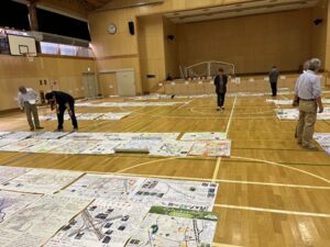
作品は11月15日から旭川市科学館「サイパル」で展示されますので、是非会場でご覧ください!
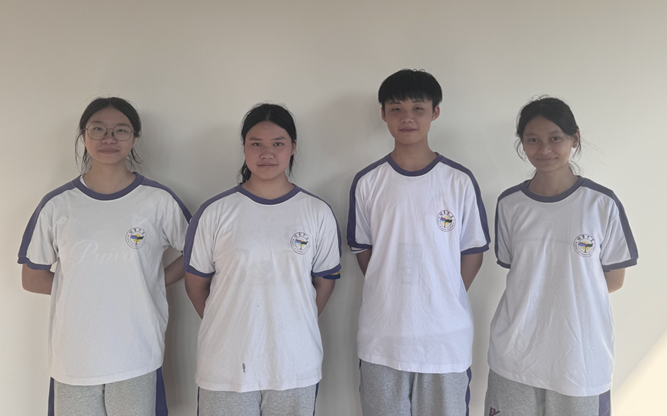
Hello everyone! We are 11th-grade students from Pui Va Middle School in Macao. Our team has students from science, humanities, and arts. Even though we study different subjects, we try to “step outside the textbook and look at the world” when we learn geography. We want to connect what we learn into a big picture, because we believe this way can really widen our view and make knowledge feel warmer and more human.
We grew up in Macao, a small city with a mix of Chinese and Western culture. We love its special style: on the streets you can see Lingnan-style arcades and also Gothic churches; during festivals there are dragon and lion dances, and also Western holiday fun. To find out why Macao has so many different building styles, we used our team’s strengths. The science students did data and maps, like making a survey on “how Macao residents understand local building styles.” The humanities students studied history. They went to universities and libraries to read old maps from 100 years ago and compared them with today’s maps to see how the land changed. The art students worked on the design. They made six types of buildings: modern Western, Chinese, Baroque, Portuguese, Islamic, and Chinese–Western mix. They used small house icons with different roof colors and placed them in the right spots.
We also went to the streets to do interviews. We looked at buildings in different areas—their looks, structure, and use—and wrote down their style features. We also listened to older people tell stories about Macao’s past. This helped us understand the history and how the buildings are used in real life. For our main map, we divided Macao into five areas. We used colors from red to light blue to show the time order of Portuguese control: red for 1557–1580 (first foothold), orange for 1580–1622 (expansion), dark blue for 1622–1784 (military control), yellow for 1784–1849 (stronger administration), and light blue for 1849–1887 (full control). This helped us explain the process and study why some building styles increased a lot in certain times. Step by step, we built a vivid picture of our hometown.
With this love for our home and our project results, we joined the Junior Environmental Map Contest in Asahikawa, Hokkaido. While preparing, we often discussed late at night—from planning and fixing map details to organizing interview stories and improving our display. We also solved problems like hard-to-find information and different opinions. Now we have won an award, and we feel very happy and honored. It shows that our geography learning and our hard work were worth it. In the future, we will keep going, find more beauty in our hometown, and share Macao’s story with more people.
日本語訳(機械翻訳)
みなさん、こんにちは!私たちはマカオの培華中学校の11年生です。私たちのチームには理系、文系、芸術系の生徒がいます。異なる科目を学んでいますが、地理を学ぶ際には「教科書から一歩踏み出し、世界を見つめる」ことを心がけています。学んだことを大きな視点で結びつけたいのです。そうすることで視野が本当に広がり、知識がより温かく人間味のあるものになると信じているからです。
私たちはマカオで育ちました。この小さな街には中国と西洋の文化が混ざり合っています。私たちはその独特のスタイルが大好きです。街には嶺南様式のアーケードもあればゴシック様式の教会もあり、祭りには龍舞や獅子舞が踊られる一方で西洋の祝祭の楽しみもあります。なぜマカオにこれほど多様な建築様式が存在するのか、私たちはチームの強みを活かして調査しました。理系学生はデータと地図を担当し、「マカオ住民が地元の建築様式をどう理解しているか」といった調査を実施しました。人文系の学生は歴史を研究。大学や図書館で100年前の古地図を調べ、現在の地図と照らし合わせて土地の変化を分析しました。美術系の学生はデザインを担当。西洋モダン、中国風、バロック、ポルトガル風、イスラム風、中西融合の6種類の建物を考案。屋根の色で区別した小さな家アイコンを作成し、適切な位置に配置しました。
私たちは街頭でインタビューも行いました。様々な地域の建物を観察し、外観・構造・用途を確認し、様式の特徴を記録しました。また、年配の方々にマカオの昔話を伺いました。これにより歴史的背景と、実際の生活における建物の活用方法を理解できました。主要な地図作成では、マカオを五つの区域に区分しました。ポルトガル支配の時代順を示すため、赤から水色までの色を使用しました:赤は1557–1580年(最初の足場)、オレンジは1580–1622年(拡大期)、濃紺は1622–1784年 (軍事統治)、黄色で1784–1849年(強化された行政)、水色で1849–1887年(完全支配)を示しました。これにより、その過程を説明し、特定の時代に特定の建築様式が急増した理由を研究することができました。一歩一歩、私たちは故郷の鮮やかな姿を描き出していったのです。
この故郷への愛とプロジェクトの成果を胸に、私たちは北海道旭川市で開催されるジュニア環境マップコンテストに参加しました。準備期間中は、深夜まで議論を重ねました。計画立案や地図の詳細修正から、取材記事の整理や展示内容の改善まで。情報収集の難しさや意見の相違といった課題も乗り越えました。今回受賞できたことは、地理学習と努力が実を結んだ証であり、大変嬉しく光栄に思います。これからも故郷の美しさを追求し続け、マカオの物語を多くの人々に伝えていきます。